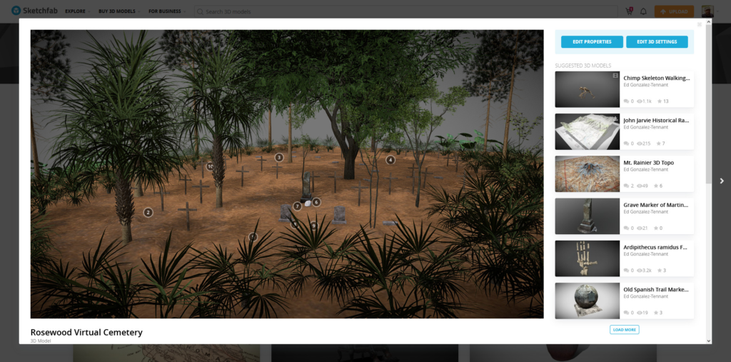
This post describes the process of building the Virtual Rosewood Cemetery available at Sketchfab (see below). The online, interactive reconstruction of Rosewood’s Black burial ground is based on several digital technologies increasingly used by archaeologists. These include LiDAR, photogrammetry, ground penetrating radar (GPR), and 3D modeling. While this post isn’t a tutorial per se, it might help folks with these skills combine them in new ways. That’s the hope!
There are several steps to creating an accurate virtual reconstruction of the Rosewood cemetery: (1) create and edit the ground surface; (2) add models representing grave markers; (3) add vegetation for increased realism; and (4) export to Sketchfab. You can view the finished produce below.
Creating & Editing the Ground Surface
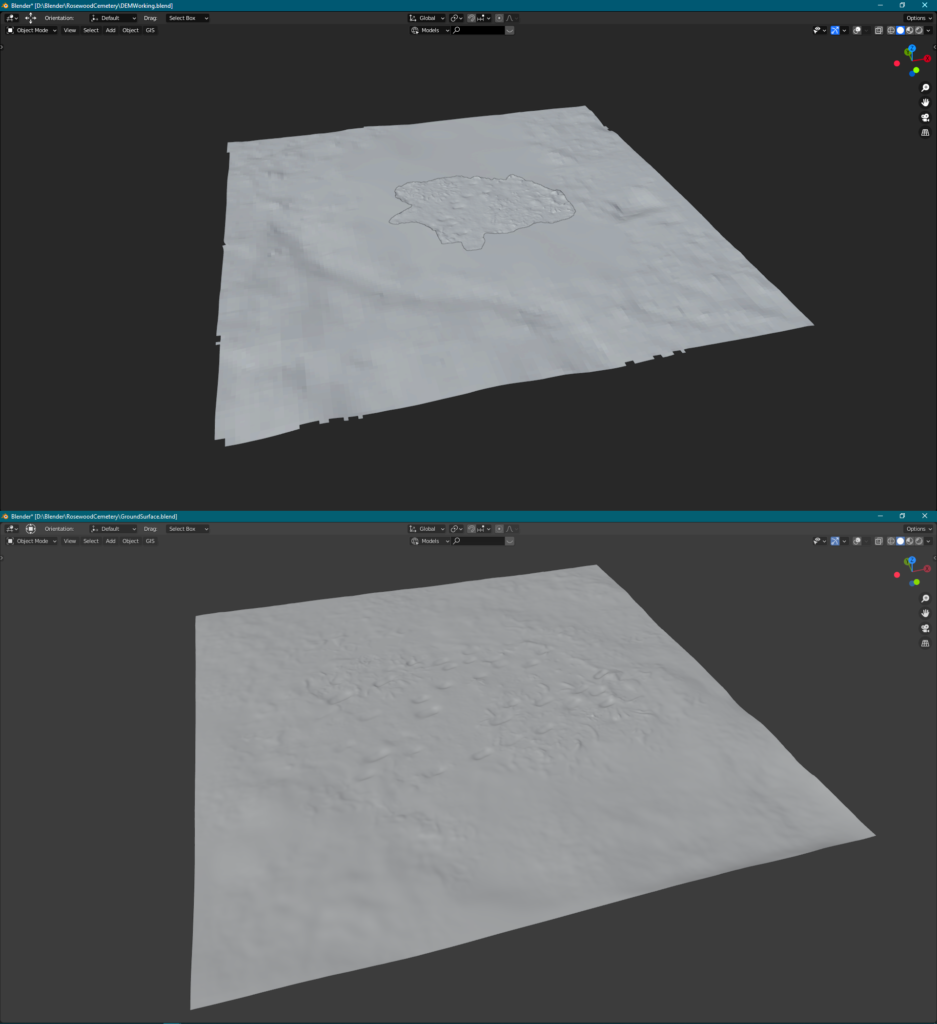
The ground surface for this model is based on a mix of LiDAR and photogrammetry. The LiDAR data is fairly old, dating to 2007, and does not provide much detail. LiDAR was processed using CloudCompare and exported to the .obj format for use in Blender. Since the LiDAR data is low quality, photogrammetry with images collected via an unmanned aerial vehicle (UAV) produced a more accurate local ground surface. The photogrammetry was processed using Agisoft’s Metashape. The LiDAR and photogrammetry models were then merged in Blender using the Shrinkwrap modifier. The resulting model was retopologized to reduce the file size using this method.
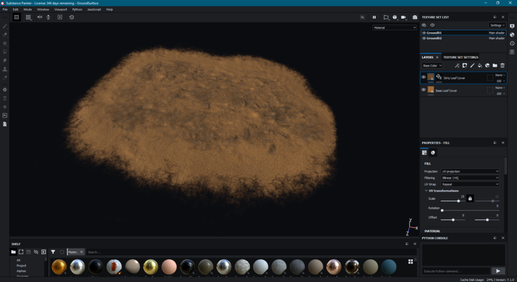
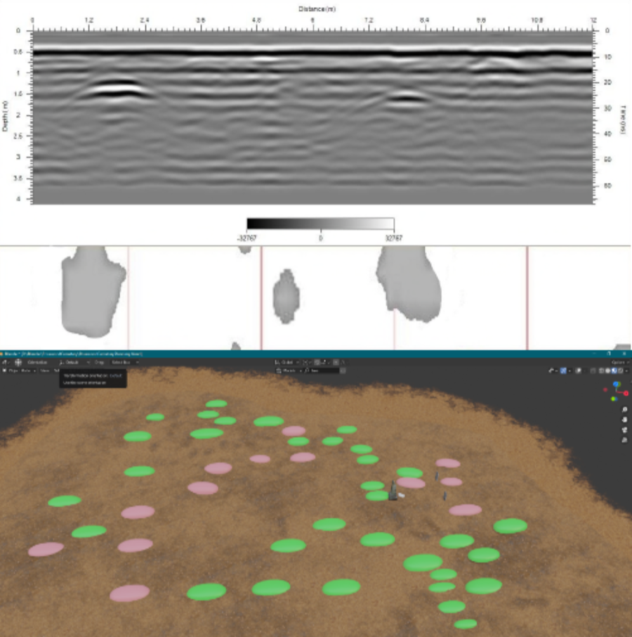
The final, relatively lightweight ground surface file was then textured using Substance Painter. GPR results, first processed using RADAN, where incorporated in the 3D model. The results were used to further edit the ground surface with the intention of representing both visible and hidden graves in the final virtual cemetery.
Adding 3D Models of Graves
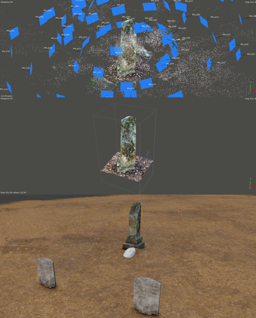
The 3D models of three graves were also created using photogrammetry. A series of photographs were taken of each grave marker and processed in this way. Then, lightweight versions of each model were created, exported, and added to the correct locations in the 3D models. These locations were marked through field mapping and appear on the photogrammetry-based ground surface.
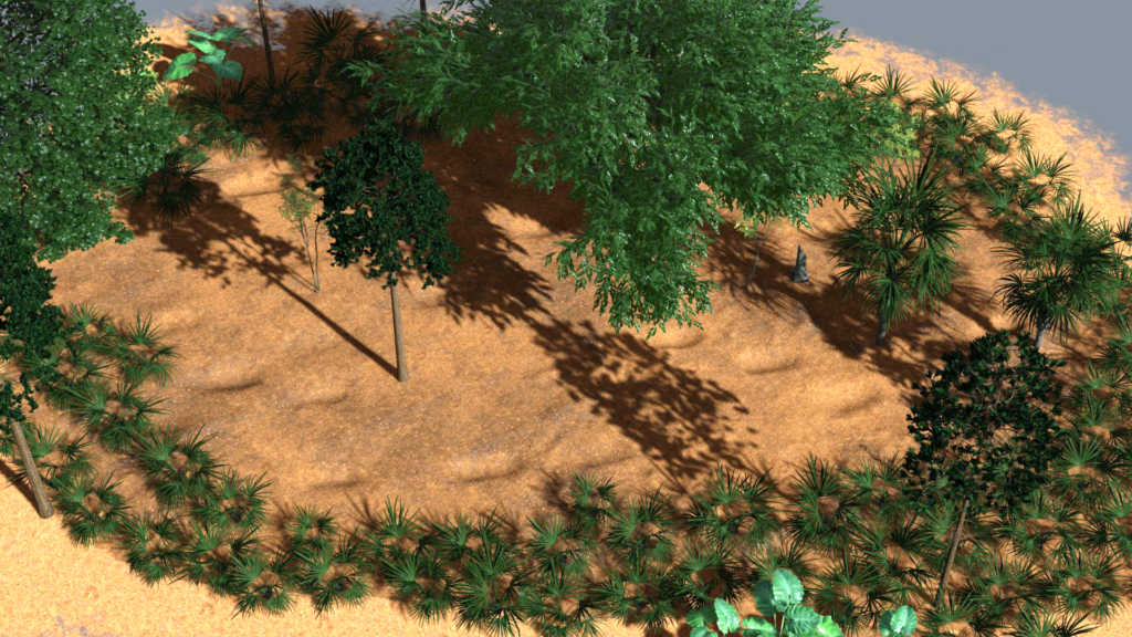
Adding Vegetation
Vegetation was added in two ways. The trees were placed based on the photogrammetry model, which accurately recorded the location and type of trees. The remainder of the vegetation was based on site mapping during fieldwork. The 3D vegetation models used here are from the Botaniq Trees and Jungle Scapes addons for Blender.
Exporting to Sketchfab
The final step was exporting the model to Sketchfab, which is much easier using the Blender to Sketchfab exporter. Then, setting up the annotations and tweaking various settings results in the finished experience. I chose this format because it allows LOTS of people to explore the content in a variety of formats, including in your browser, via VR goggles, and even as an AR experience.
Overall, putting this virtual experience took 2-3 days of full time work. Of course, that was possible because the photogrammetry and GPR analysis previously occurred. Still, that’s a relatively short amount of time to produce a useful visualization of an important African American site.