My BA degree is from the University of Arkansas, where I was lucky enough to know Dr. Robert “Bob” Mainfort. He is well-known among Southeastern US archaeologists for his work at Pinson Mounds (and elsewhere). We once spoke about creating a 3D reconstruction of Pinson Mounds. That was 15 years ago. I never got around to it, until now!
Constructing 3D models of archaeological sites is so much easier now! The above model was constructed using 2015 LiDAR data freely available from the USGS National Map. I downloaded point clouds in .LAS format and processed them with ArcGIS. I then symbolized the LiDAR ground points with a black/white scale and exported it as a .tif image.
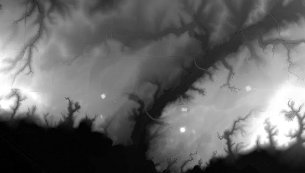
The above image serves as a heightmap, meaning that I can import it into a 3D modeling program like Blender and reconstruct the landscape. In this case, I also use the Image Analysis toolbar in ESRI ArcMap to create a compelling visualization as the texture. Combine them all together and we have a 3D landscape of a really cool Woodland period site! The entire process took me an hour or so.
I’ll likely do this for other sties in the coming months. I’m thinking about this in relation to the recent edited volume by Price and Carr – Investigating the Ordinary: Everyday Matters in Southeast Archaeology – and their call to make archaeology more accessible. I’m engaging the students in my Southeastern Archaeology class using this and similar models. Ultimately, I’m curious how these kinds of visualizations might engage public perceptions of sites.
It should be interesting. If nothing else, it’ll produce some cool looking models!
Note: this post was originally located at www.gonzaleztennant.net. I’ll be returning to this work in the coming weeks to update the workflow with open source software so anyone can made these visualizations! Stay tuned!