The remarkable Schomburg Center for Research in Black Culture has digitized versions of their Green Book collection. These books are part of the public consciousness following the 2018 Green Book movie and will be a part of the forthcoming HBO series Lovecraft Country, based on Matt Ruff’s book of the same title. Published between 1936 and 1966, these books provided a growing African American middle class with useful guides for navigating Jim Crow America.Many such resources existed for African Americans during this time. For instance, here’s a 1942 Afro-American Travel Map. This map conveys much of the same information as the Green Books in a single image. This post is about using QGIS to rapidly relocate each of these places, and the research potential they present.
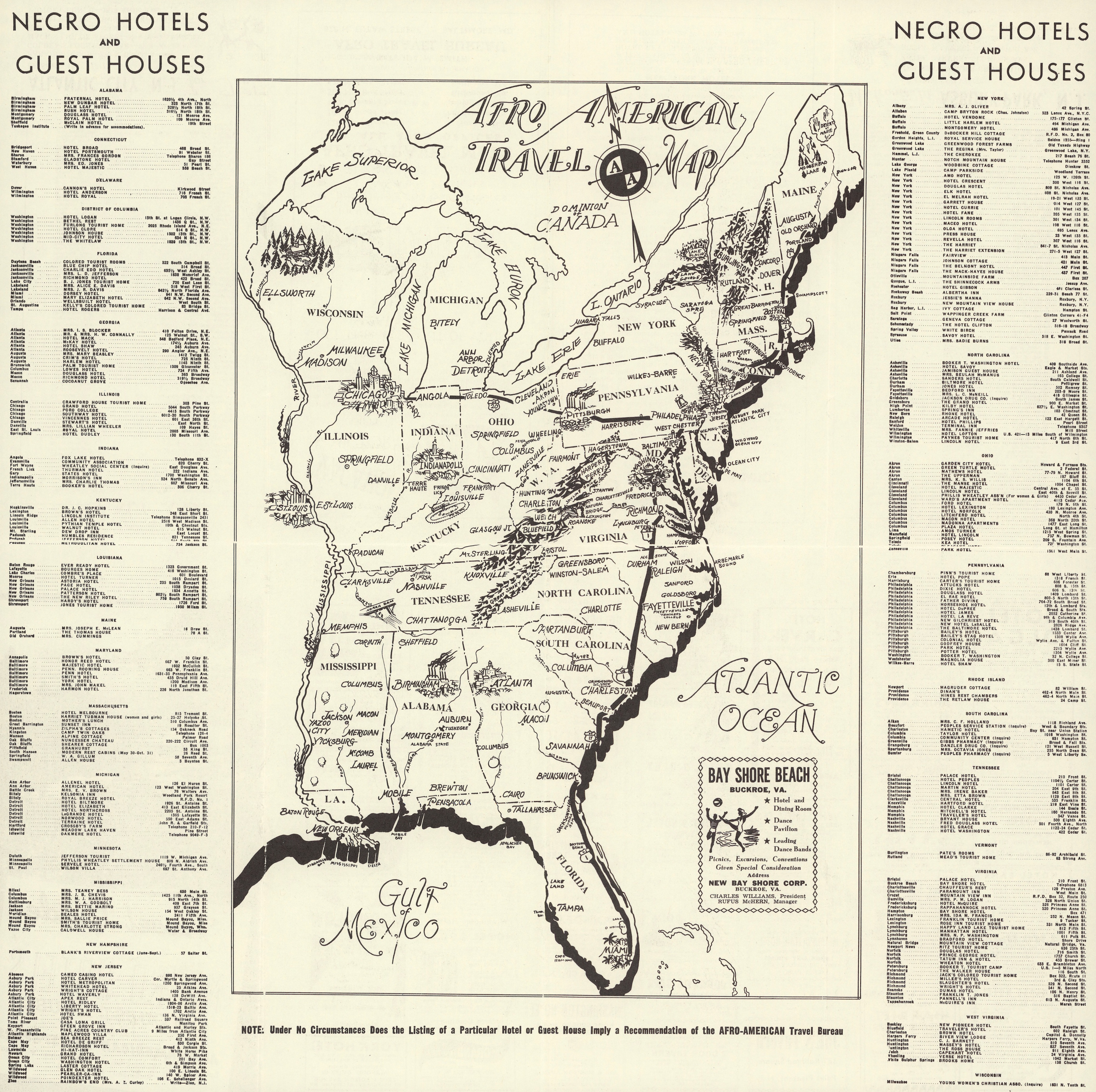
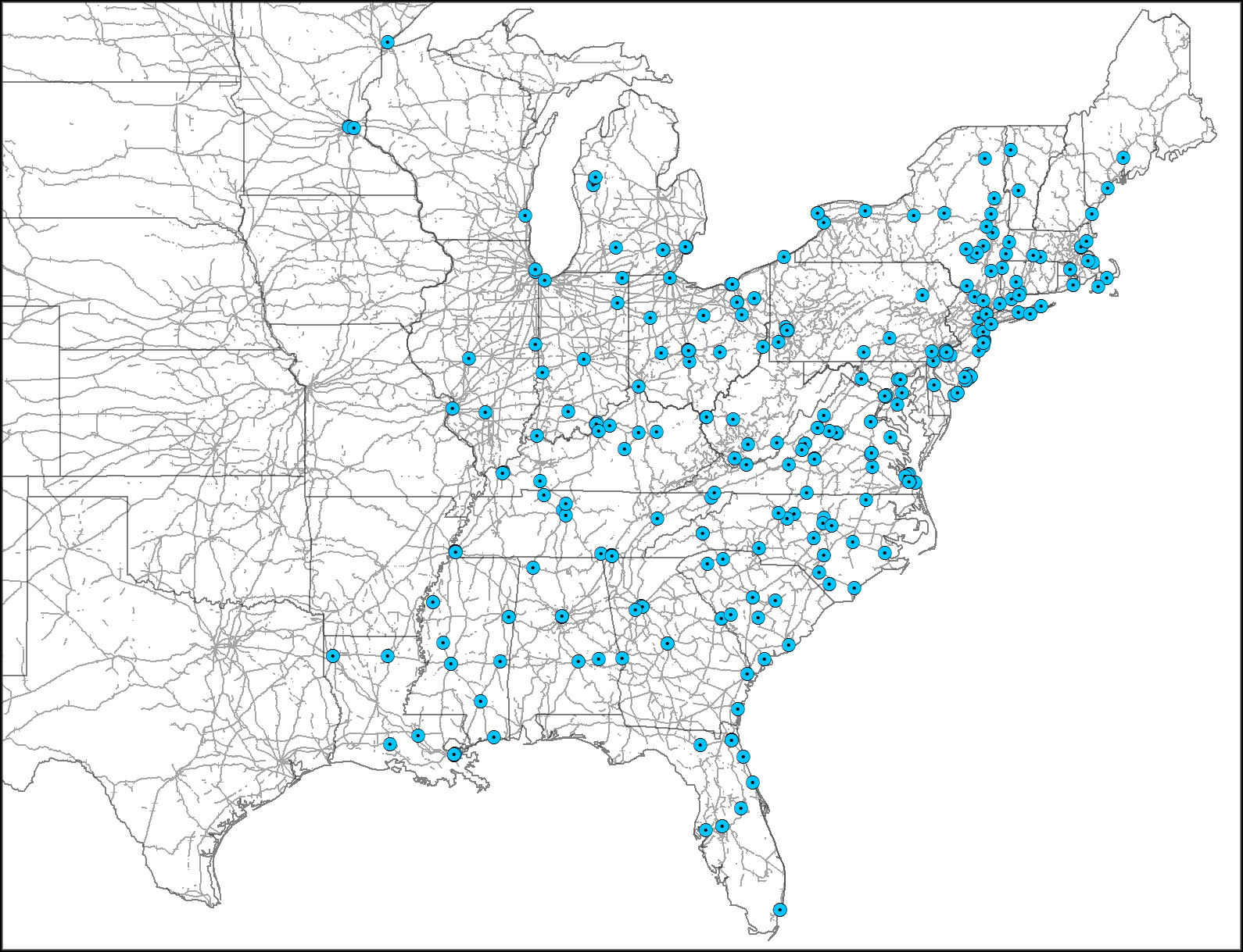
This map records the names and addresses for approximately 350 hotels, motels, guest houses, and other establishments that provided overnight housing for African Americans. This is information that can be geocoded. Geocoding refers to the process of assigning geographic coordinates to postal addresses. Geocoding a spreadhseet of addresses is fairly straightforward with QGIS, my preferred open source GIS.
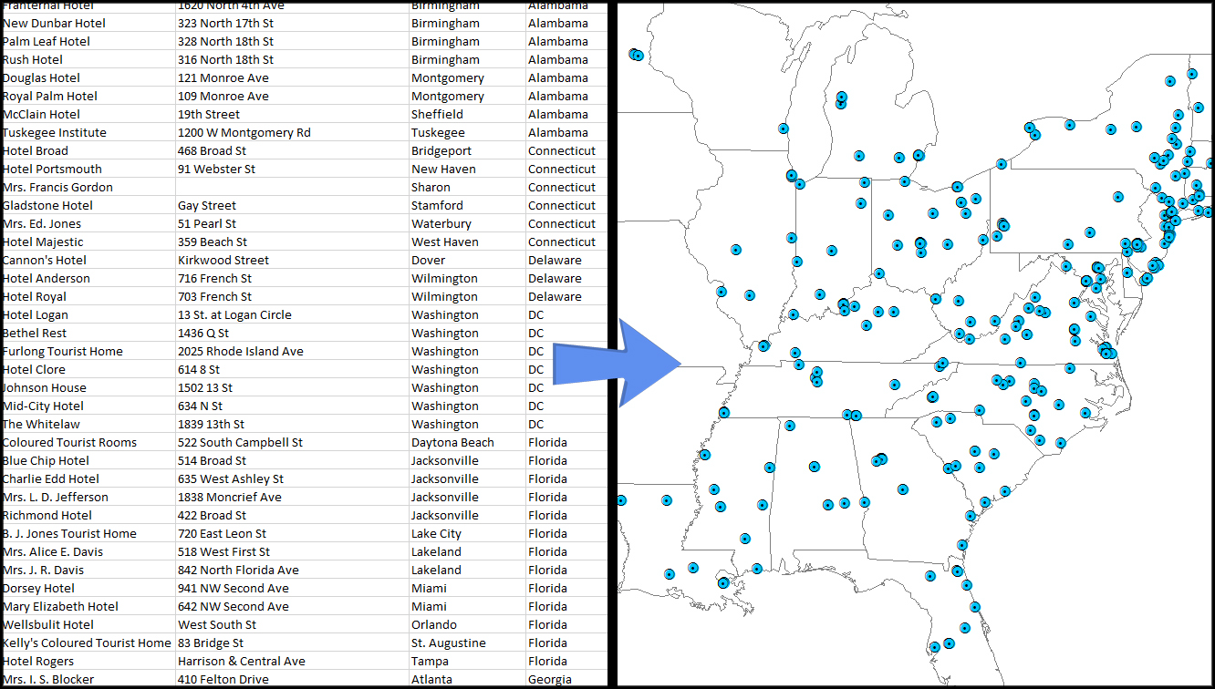
While entering the addresses into a spreadsheet is a time intensive process, it did allow me to check many of the addresses using Google Maps. Many of the addresses need to be adjusted or updated. The most common reason being that streets change names over time. For instance, several of the locations in Chicago list South Parkway as part of their address. Today, South Parkway is known as Martin Luther King Jr. Drive.

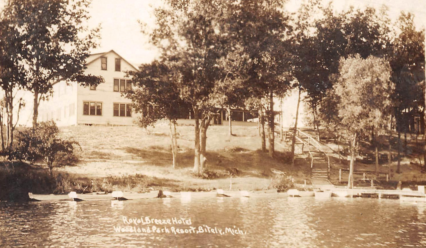
These sorts of maps hold great promise for researchers and students of African American history. They expand our knowledge regarding the variety of African American communities in the past. These were far from homogeneous places! After all, how many are aware of the Royal Breeze Hotel at the Woodland Park Resort in Bitely, Michigan? The history of Woodland Park is fascinating. Founded as an African American resort in 1921, the Royal Breeze Hotel opened its doors two years later. It looks like a great place to stay with a beautiful lakeside view. Unfortunately the Royal Breeze is no longer standing, having burned down years ago. The destruction of these Black places an all-too-common occurrence in 20th century America.
While large and grand hotels are fascinating, what catches my attention is the practice of many African Americans opening their private homes to travelers. The historian in me appreciates the opportunity to learn more about these places. The archaeologist in me wonders about the material culture of a mid-20th century African American guest house. This map points us to some possible sites for examining both sets of topics. Again, unfortunately, the sad reality is that many of these structures – in use 50-60 years ago – are no longer standing, presumably victims of the same gentrifying forces responsible for displacing countless African American communities. That said, in a handful of locations, the structures appear to be intact.

The research possibilities raised by this one map reflect a growing interest in researching African American travel during Jim Crow. While these guides and maps are often associated with the acquisition of cars by African Americans, I can’t help but wonder if many places were located near highways and major railroads. Did many of these locations offer both middle class and working class African Americans a safe place to stay while traveling? These are the sorts of questions we can answer by exploring various forms of spatial analysis (e.g., distance analysis) and new digital history resources. After all, we now have access to the 1940 census.
Other projects have taken information from the Green Books and mapped them. The University of South Carolina Library’s Digital Collections has provided an interactive display of locations from the 1956 Green Book.I hope to complete a similar project for Florida in the coming years (perhaps as a crowdsourced initiative). This kinds of data will allow me to visualize the lengths of operation for different establishments (e.g., hotel, guest house). It also supports analyses of locations in reference to other social factors, and forms of analysis I’ve not even thought of yet. Stay tuned, it’ll be exciting stuff!
Interested in examining the data? Here’s a hand web map. The search function is restricted to the name of each location. As such, you can reference the image at the top of this post and search for a specific, named hotel or guest house.
Note: this post was originally located at www.gonzaleztennant.net from October 2015. This is an updated version of that post, including a newly generated web map.