QGIS – the world’s leading open source geographic information systems (GIS) software – has a lot to offer archaeologists and other cultural heritage workers (e.g., historians, architectural historians). QGIS is freely available online and runs on most operating systems. The following educational materials resulted from the disruption of my field school in summer 2020 due to COVID. Initially disappointed, I decided that open source GIS software provided an alternative experience for my students. This faced several challenges including a closed campus and difficulty with installing proprietary software on personal computers. QGIS provided a convenient solution.
The resulting six-week course assumed no prior GIS experience, allowed students to use their personal computers, and not use on-campus resources. The course had the following description:
This course examines the use of open source GIS for archaeology and cultural resources management (CRM). Topics covered will include an introduction to QGIS, working with various geospatial data, georeferencing and digitizing maps, processing remotely sensed data, and completing a predictive model. This work is sometimes referred to as a desktop survey. No previous GIS experience is required.
This course and the field school it replaced are part of a partnership with the US Forest Service. Students were assigned portions of the Ocala National Forest corresponding to quadrangles to concentrate on for their weekly assignments. Weekly readings were paired with one or more video tutorials and various assignments across six weeks. The course is designed to quickly get students to the point where they can produce a rudimentary predictive model.

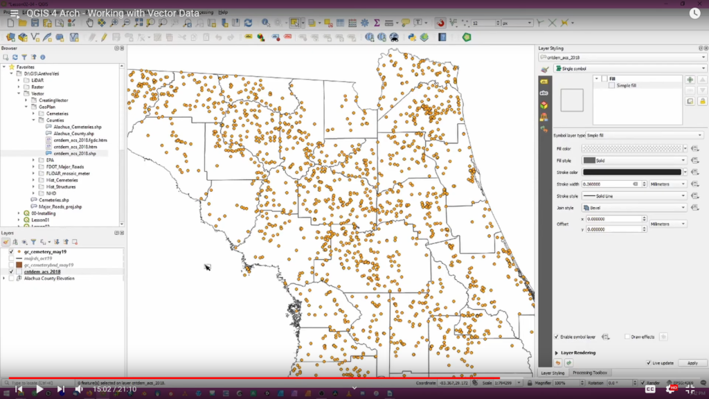
Week 1 included two videos on installing QGIS software and the basics of geospatial data (see above). The assignment focused on a short paper exploring which aspect of archaeological GIS students found most interesting (based on the week’s readings). Week 2 introduced the basics of working with vector and raster data. The assignment required students to clip vector and raster data to their individual areas of interest (AOI) and write a paper describing the importance of properly preparing geospatial data for analysis. Every video in the series is divided into timestamped sections, allowing viewers to quickly move between sections. For instance, the fourth video lesson (see below) includes the following sections: a brief introduction to the lesson, creating points from a CSV file, digitizing features, creating a grid of points within an AOI, joining tabular data to vector files, selecting vector data, and clipping vector data.
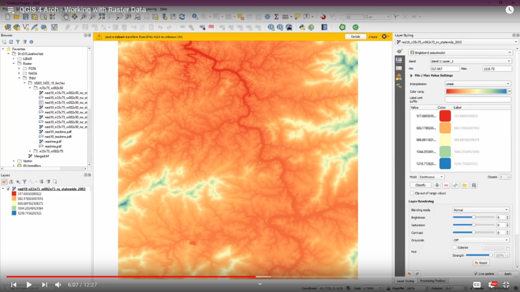
Similarly, the fourth video (Working with Raster Data) has the following sections: topics for the lesson, an overview of the ypes of raster data, downloading data from USGS National Map website, symbolizing and merging raster data, clipping raster data, and working with contour lines.
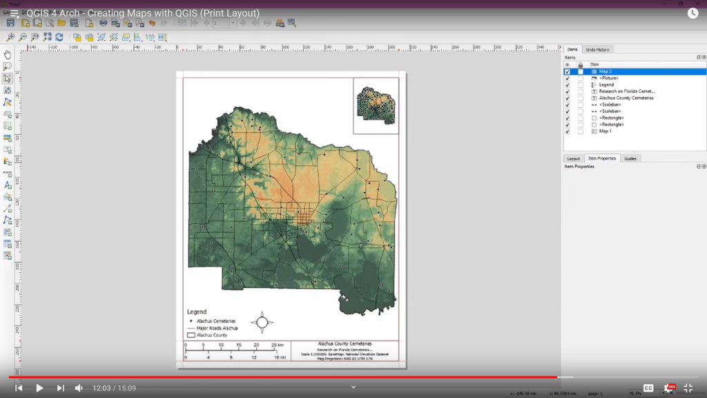
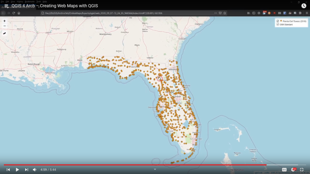
Week 3 centers on working with thematic data and producing maps with QGIS. The weekly assignment has students mapping thematic data (USDA soils data), creating a thematic a map, and writing a short paper discussing their decisions for symbolizing the data.The first lesson for this week explores thematic mapping. The second video examines producing maps using the Print Layout function in QGIS (see below). A third video explores the creation of interactive web maps using the QGIS2Web plugin.
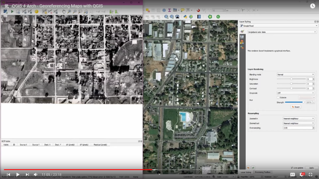
Week 4 covers georeferencing historical aerials and maps. Students download aerials from the mid-20th century, compared features to those recorded on 19th century GLO maps from the Bureau of Land Management, and digitize cultural features from both periods. The associated video lesson explores georeferencing with coordinates, without coordinates, and using grids like the Public Land Survey Systems (PLSS). It concludes with additional lessons on digitizing features.
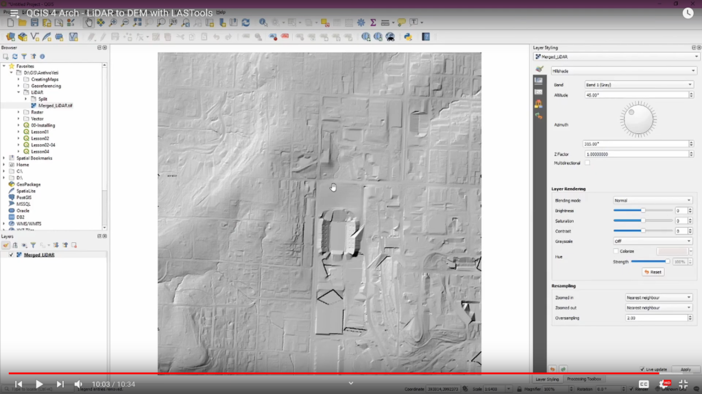
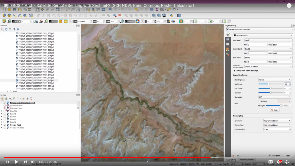
Week 5 focuses on processing LiDAR and Sentinel-2 satellite imagery. The LiDAR analysis uses free tools to convert publicly available data into a digital elevation model (DEM). The second video lesson for this week explores how to create various band combinations and normalized difference vegetation index (NDVI) from satellite imagery. The weekly assignment involved creating the above outputs for each student’s AOI and a short paper.
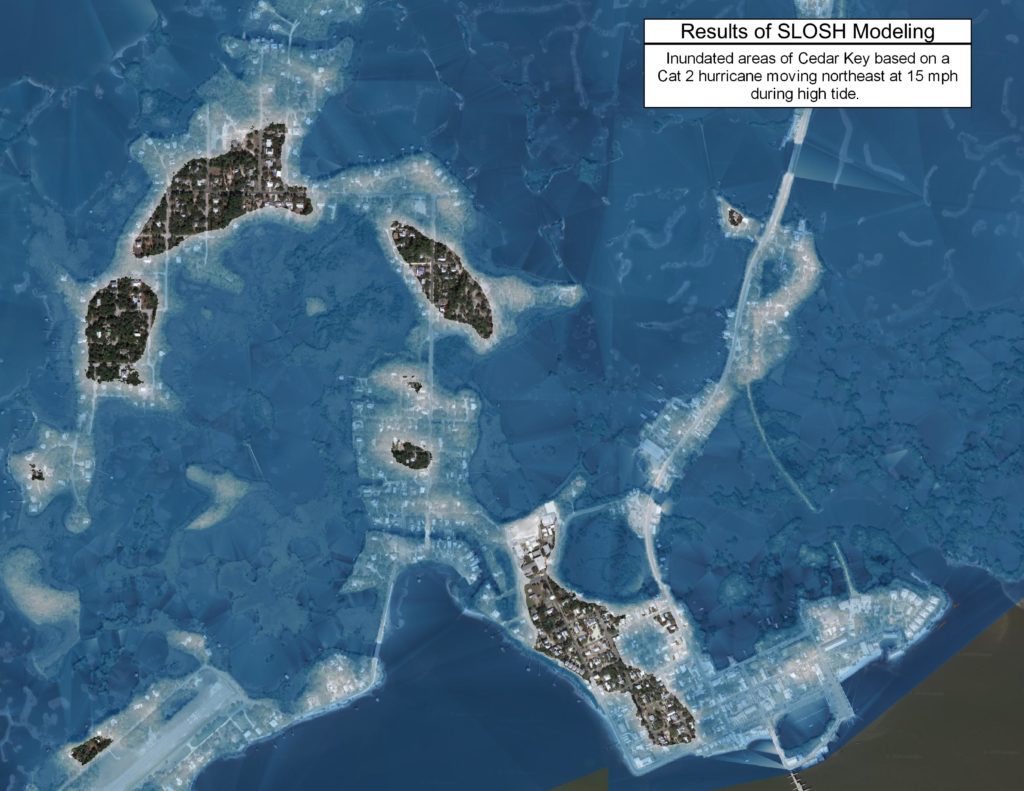
The course culminates in Week 6 as students combine lessons from previous weeks to complete a simple predictive model for their AOI. The weekly assignment involves sharing the results of the model for their AOI and writing a larger paper reflecting on the course. Students responded well to the course and I was impressed with how quickly they mastered complex geospatial operations. I’ve continued to add to the online course, including a tutorial on visualizing inundated features based on the Sea, Lake and Overland Surges from Hurricanes (SLOSH) storm surge model developed by the National Oceanic and Atmospheric Administration (NOAA). Numerous shorter tutorials add depth by exploring the use of free basemaps, SRTM data, pansharpening Landsat 8 imagery, importing soil data, and fixing common errors.
You can view the QGIS 4 Archaeology course via YouTube here. I’ll continue to add additional videos over the coming months. Please, feel free to use these videos as part of your courses and workshop. I hope they prove useful for many, many folks!